Saturday, May 31, 2014

2014_05_31 Puyallup Cyclopaths’ Cayuse/Chinook Pass “Snow” Ride


Scott, Martin, Les, & Dwaine...
Les, Dwaine, James, & Scott...
Conor, John, & Jim...
The weather forecast sounded good:  a high of 70 degrees for Greenwater with 0% chance of precipitation.  Conor, John, and I arrived at the Crystal Mountain turnoff from highway 410 (our designated meeting spot) at around 6:25 AM.  When we arrived, Leon and Rob had already arrived (they got there early and rode up to Crystal Mountain Ski Area for a little extra training) as well as Rick and Jim.  By the time we were ready to head out (about 6:45 AM), we had a nice group of riders (John, Conor, Mike (me), Leon, Rob, Mark, Chris Nelson, Martin, Scott Wagar, Jim, Les, Dwaine, Rick, and James).  As we headed up toward Cayuse Pass, things split up quickly with Conor, Chris, and Rob riding out of sight almost immediately. 


Cayuse Pass:  John, Dwaine, Les, & Jim...
View on way up from Cayuse Pass to Chinook Pass...
We regrouped at Cayuse Pass and headed up toward Chinook.  At this point, it was cool (maybe mid-forties) but not cold.  Most of us were dressed warmly based on the assumption that the descent down the east side of Chinook Pass would be cold.  We made our way up to Chinook Pass in various groups and regrouped at the summit.  At the summit of Chinook Pass, it was pretty warm.  It was clear that many of us had overdressed.  
Summit of Chinook Pass...
At that point, jackets and layers of clothing started to come off.  The problem with the descent down the east side of Chinook was not the cold – it was the other humans with whom we shared the road.  One of the vehicles that passed us thought that it would be fun to dump tacks on the road (keep in mind that it was early morning, and we were not holding up traffic in any way).  As we descended from Chinook Pass, we suddenly saw bright shiny objects (tacks) all over the road.  Before long, our group had sustained four flat tires – which slowed us down but did not diminish the beautiful weather and the fun.  We proceeded about 8 miles down the east side of Chinook, turned around, and headed back up.

Our road snaking down toward Cayuse Pass...
Once we arrived back of the top of Chinook Pass, we proceeded down toward Cayuse Pass. 
Heading back down from Chinook toward Cayuse Pass...
This section of road is stunning both for the scenery and for the views of the road snaking beneath you toward Cayuse Pass.  The original plan had been to descend all the way to the bottom of the other side (south side) of Cayuse Pass and then turn around and come back up.  Unfortunately, the flat tires had slowed us down enough that we only proceeded part way down the south side of Cayuse before reversing our course and heading back up. 

Once we had regrouped at the top of Cayuse, we headed down the north side to our cars.  This sections is all downhill, and we flew (unfortunately, no photos as I was busy just trying to keep up).  As usual, Conor took off like a bullet.  Before long, I found myself following Rob and Rick who were in pursuit of Conor.  Rob is a big man, and the draft behind him is phenomenal.  The problem is that you can’t see the road when you are drafting behind Rob; and – at 40 mph – even little bumps can be an uncomfortable surprise.  We were slightly below – or sometimes slightly above – 40 mph for much of the descent.  As fast as Rob and Rick were going, we still did not manage catch up to Conor until the bottom of the descent. 

Back at the cars, Leon and Rob headed up toward Crystal Mountain Ski Area one more time with Martin and Scott Wagar also heading up.  The rest of us headed home.  I heard later from Leon that he and Rob went part way up, turned around and headed back to Rob’s vehicle.  Martin and Scott went all the way up to the ski area.

The weather was perfect for this ride as you will see in the photos.  To view all of the photos from this ride, click on the following link:  https://plus.google.com/photos/103821724300588557330/albums/6020174399606198753  .

Monday, May 26, 2014

Alder Lake Loop (with "The Climb" added) Ride: The view from the Peloton……..


Author:  Mark Delrosario

 
On the morning of Saturday May 24th a merry bunch of Cyclopaths and our friends embarked on our annual Alder Lake Loop ride.  The group started out 20 cyclists strong enjoying good company, perfect springtime weather and dry roads under our wheels.  We were 2-3 bikes wide stretching 20-30 yards in length giving the feel of riding in a peloton.  It took cars a little longer to pass.  By the way, this is the largest group that I have encountered in my 3 years riding with the Cyclopaths.
 
Heading out past the old mill just south of Orting
 
Our starting pace from Orting via Orville Road to the Kapowsin Highway intersection was a steady rollout.  After the little hump to the intersection, we turned left and the pace increased slightly as the profile of the road changed to undulating terrain.  Luckily for the rest of us Rob dropped his coat and had to turn around for it.  For those of you who have not had the good fortune to ride with Rob, Rob has the powerful ability to pull the entire group at crazy speeds.  We all know Conor is
Martin, Scott, and Conor leading the "pelaton"
straight up fast but many do not know that Les is a silent assassin on the bike.  If the three of them and one of our friends started to pull away, to be honest we might not have seen them again until the end of the ride.

After the customary stop at the boat launch, we hit Highway 161 (Meridian) up to the right hand turn onto Ohop Valley Road.  We traversed this quiet country road thru the serene Ohop Valley and past Pioneer Farm.  Along the way, we might have encountered a possible moonshine deal as two trucks hogged the road and forced us to pass single file between them.  I recall some talk that they might have been Scott’s distant relatives.  Jack I and Jack II if memory serves me right. 

The majority of the group was still together but starting to string out as we turned left onto Highway 7 (Mountain Highway).  On Highway 7 the profile of the road starts as an incline up to the Eatonville Highway T, then a small fast descent and right hand bend before turning towards La Grande where the real climbing of the ride begins.  From there it is a 3-4 mile stretch to the lookout point with a view of the La Grande Reservoir Dam.  There happen to be several Strava segments in this section.  I see that many of us either set personal records or had some of our strongest times.  Congrats on the strong riding everyone.  I used to worry that the fast GC guys would be waiting at the top for a long time.  Riding with the Cyclopaths I have come to realize the quality of the group makes you stronger and whether you like or dislike climbing you are forced to embrace it and improve.  17 of us survived the ride to this point and we took our traditional mid-ride picture.
 
Viewpoint:  Alder Lake Dam
 
From the lookout point there is a descent to the left hand turn onto Alder Lake Cutoff Road.  The peloton split up after the immediate rise and before I knew it the GC guys took off in a paceline on the rolling terrain.  I was caught in no man’s land for a short while before Erik came charging from behind with his comrade.  Erik was a monster and pulled us at 26mph for a long stretch to Eatonville, where the GC guys were waiting, Rob had rejoined the group and where the rest of us chasers reformed the peloton.

The unity was only to last so long on the return trip on Orville Road as the paceline eventually dropped those of us not able to hold the wheel.  Mind you I am not fond of Orville Road because of the chip seal.  Before we knew it we were back at the Orville Road – Kapowsin Highway intersection for a stop and regroup.  Orange Shoes (Dr. Nick) and I started off early towards ‘The Climb’ up Camp One Road.  Speaking for myself if I
"Pee break" at the base of The Climb
waited mentally I would not have stayed motivated.  Best to start before you think about the choice of going up the 5 mile Category 3 climb after 50 miles and tired legs.  We hit the base and progressed upwards with a steady manageable pace where we could talk and not go into the red.  In our absence, we missed partaking in the candid camera picture of the group's nature break.  Our camera man always seems to sneak in one of those pictures. 

We encountered extra traffic for a Saturday morning.  One in particular, a black truck with rims was too nice to be a utility truck for the logging or gravel company.  We would, eventually,  come across the truck parked at the top.  The driver, Travis, was out to enjoy the nice day and the beautiful view of the valley and lake below.  Later, he would be nice enough to be our camera man and take a picture of the 18 of us still left in the peloton and a selfie of his own. 

Our breakaway survived thru mile 3 when I spotted
"Travis selfie" with Cyclopaths (and view) in backgroun
two Cyclopaths in my mirror.  Knowing we started early, I had to give it a try to hold on to the end.  Les and Rob caught me at mile 4 (aka Leon’s mile).  Les might not get as much notoriety but he is up there in all the rides.  Conor was right behind with a half-eaten bacon maple bar doughnut he stashed away from the bakery in Eatonville.  Watch out because when the sugar kicks in Conor gets a boost of energy.  Next to follow was Andy, Mr. Randonneuring himself, who PRed on the Strava segment.  The week before Andy did a 250 mile ride from Seattle crossing into Canada and back.  That is an incredible feat of endurance.  By the top of ‘The Climb’, I could see Mike and Jim closing in fast.  Jim bought himself a new sleek carbon fiber Cervelo.  The new bike is a stark contrast to his old school purple steel bike with down tube shifters.  I will miss seeing his old ride.  I can imagine that Jim now feels like he is riding a state of the art Ferrari.  Like a mountain top finish, Cyclopaths and our friends trickled up to finish at the top of 'The Climb.'  While the rest of us took a break, Leon and his OCD (Obsessive Climbing Disorder) continued to ride around and gain additional elevation.

A short story about ‘The Climb’ and the beginning of my adventures with the Cyclopaths.  I  started cycling in the beginning of 2011.  It was in December of that year that I was out trying to get base miles in ahead of the upcoming season.  As I humped over the Shaw road overpass I saw two cyclists (Leon and Mike) turn towards the Orting Trail.  It took me until McMillan to catch these guys.  We started talking and they asked if I would be interested in heading out to Kapowsin with them.  Little did I know that they were taking me out to ‘The Climb.’  They shepherded me up like Super Domestiques.  Looking back at Mike’s Strava time we did it in 33 minutes.  The time is not particularly great by any standard but the journey up the hill is indicative of Mike, Leon and the rest of the Cyclopaths.  At times it may feel discouraging to be dropped and be the Lantern Rouge but when you ride with the group be assured a Cyclopath is there to look out for you.  At the end of a ride there are always words of encouragement.  ‘The Climb’ is a special place for us.  It is like the Cyclopath's equivalent version of a pilgrimage to Mecca or Jerusalem.  Mike and Leon paved the foundation for the rest of us to partake in a brotherhood and face challenges together.  When I ride with our jersey I feel a great power from wearing our Orange and Yellow colors.

Getting back to the ride, we hammered the descent and began forming pacelines to head back to Orting.  I recall seeing Scott flying down a parallel road to join the fastest four or five strong riders.  They took off and averaged 27mph from Electron to Highway 162.  Amazing that he could do a 70 mile ride with literally no recent miles under his belt.  The larger paceline that pursued was split by traffic with the lead bunch averaging 25 and the handful of the remainder 24mph.  We tried in vain to bridge the gap.  However, there is something about seeing bright colors up the road and knowing they are a carrot in front of you.  Must be like a Bull seeing the color red.  By Orting we caught the tail end of our original paceline rolling into the parking lot.  By UCI rules we'd received the same time if there is no break in the line of riders as they cross the finish line.  Ha ha, been watching too much world tour on the internet. 

It is official.  Our second ride of the year is in the books.  It was a fun time had by all.  Thank you to everyone that joined us.  You are welcome to our next Cyclopath adventure.
 
To view this ride's video, do the following:
  1. Click on this link:    https://www.youtube.com/watch?v=mYqEo9eKuZQ 
  2. Click on the "gear-like" icon at the lower right hand border of the video screen and select 1080p
  3. Take the video to "full screen" by clicking on the rectangular icon at the lower right corner of the video screen
  4. Turn on your speakers and enjoy
To view the photos associated with this ride, click on the following link:     https://plus.google.com/photos/103821724300588557330/albums/6017533882576551905?banner=pwa

Sunday, May 25, 2014


Author:  Mike Hassur


This is a brief blog post regarding our fellow Puyallup Cyclopath, Leon Matz.  Leon was featured in the “Adventure” section of today’s Tacoma News Tribune (Sunday, May 25, 2014).  The article detailed Leon’s pursuit of the 100 toughest cycling climbs in the United States, last year’s injury that delayed (but not derailed) his plans, and his continued efforts toward that goal.  If you haven’t read the article, you will find it very interesting.  Click on the following link to see the article:
               

Tacoma News Tribune Article On Leon Matz

Saturday, May 24, 2014

Our Buddy Travis


Author:  Mike Hassur
 
 
This will be a short post.  We did the Puyallup Cyclopath:  "Alder Lake Loop – and The Climb Ride" today.  We will recount that ride in a blog to be posted soon.  This short entry is to introduce you to “Travis”.  We were riding up The Climb (near the top) when we see this black pickup truck parked in the opposite lane.  The driver of the truck was standing in the bed of the truck surveying Lake Kapowsin and the beautiful valley that one sees from this vantage point.  He smiled and said “hi” as we passed on our way up.  At the top, I turned around and headed down; because I wanted to find a good spot to take a group picture with the valley in the background.  I told the guys what I was doing and took off.  When I got down to where we’d seen the pickup, it was still there with its driver still standing in the bed surveying the valley.  I stopped, said “hi”, and asked what he was doing.  He smiled and said that he had grown up in the area and had always loved coming up to this spot to relax.  I shared with him that we came out here a lot and loved it as well.  By the time the rest of the group had arrived, I had learned that his name was Travis and he’d learned my age (he’d noticed me as we went up and wondered what my age was).  Anyway, he was kind enough to take a couple of group photos of us – which you will see in the blog post for the entire ride. 

The reason that I’m writing this blog post is because he took a picture of himself with us (and the valley) in the background, and I think it is one of the funniest/coolest photos any of us have ever taken on one of our rides.  There have been better photos in terms of scenery, etc.; but this one just seemed to capture the moment:

A TRIBUTE TO TRAVIS


Saturday, May 10, 2014

Mudslide At The Climb

Author:  Mike Hassur


Leon was riding near the top of The Climb about a week ago when he heard a roaring sound, looked ahead, and witnessed a mudslide (complete with a large, uprooted tree stump) that covered most of the road directly in front of him.

5/10/2014 Mudslide near the top of The Climb

The next day John Winter and Scott Larsen were on The Climb and took a picture in the same spot - the road had been completely cleared with only some dirt residue left on the road where the slide had been.  
5/11/2014 Mudslide area at The Climb - one day later


It is amazing how well Camp One Road is maintained.  Kudos to Pierce County.

Monday, May 5, 2014

Southwest Winter Riding


Author : Brent Moody


The Southwest this winter, awesome awesome weather! Waking up to high 40s in the am and 70s during the mid-day, perfect riding weather. 

 
SAN DIEGO CENTURY RIDE
My wife and I had to take our RV into service, so it would be out of commission for about 5 days, so perfect time to take a trip San Diego to see our daughter! She lives in the Pacific Beach area of San Diego, so was drooling to get a century ride in there. We arrived there over the weekend and took in some beautiful sites around the area with my daughter, since deciding the best day to ride would be on Monday.


I called a few bike shops and surfed the web, finally finding a decent century route and try to escape most of the traffic. I headed out from our hotel and rode along some the bike trails along the freeway to get to the beach. Tricky around there trying to find these bike paths and routes.  I found a route that went thru the back country going north of San Diego by Miramar Air Base; thru the mountains of Rancho Santa Fe, up thru Escondido, and then back west to Carlsbad.  

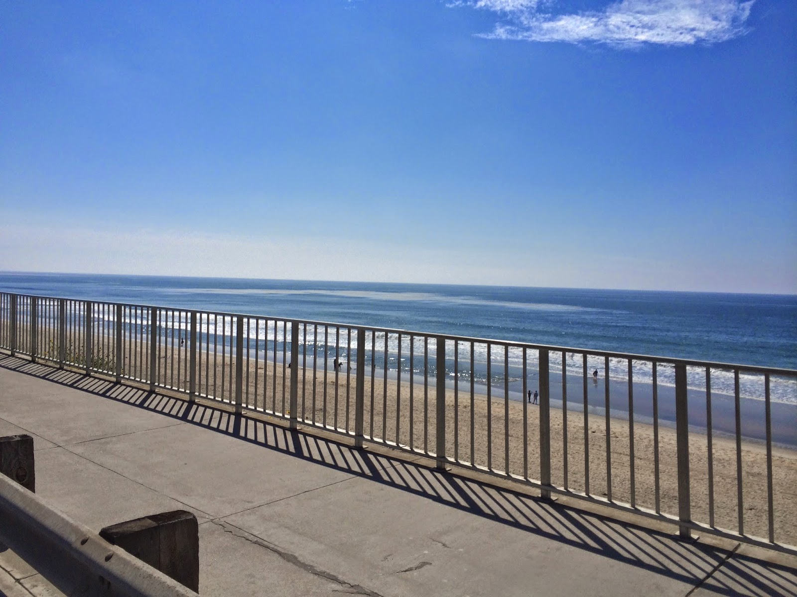
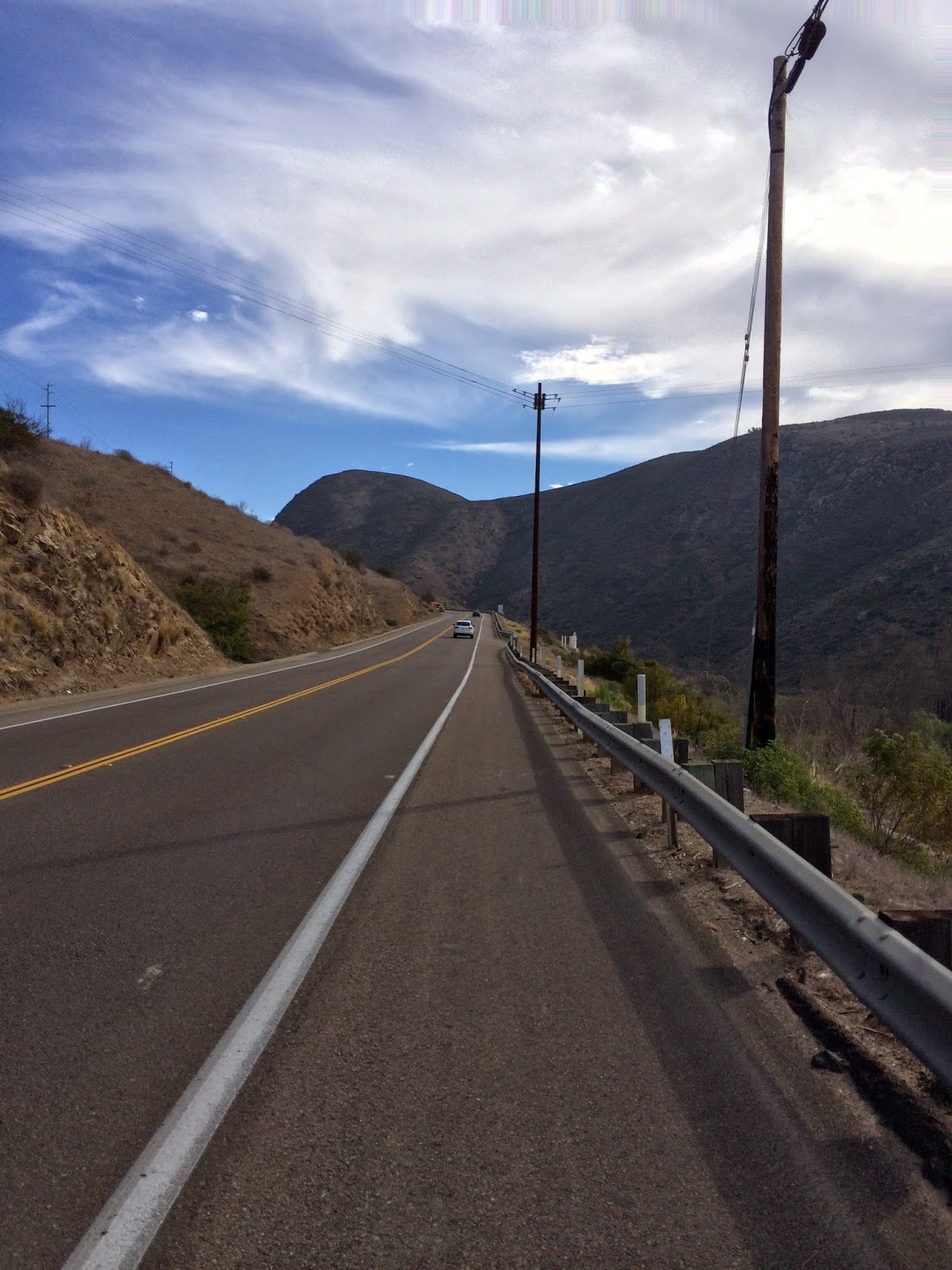
This turn to Carlsbad I caught the westerly winds coming off the Pacific. Tough ride to the coast, which was approximately 20 miles. Once arriving in Carlsbad, I quickly found the Pacific Coast Hwy, which is a beautiful route down along the coast. I stopped near Del Mar and had a bite to eat and sat in amazement of the ocean and 70+ degree weather, bright and sunny! The last part of my ride was the most memorable, weaving in and around the canyon roads around La Jolla. That ride was a challenging one I was very tired, which there were a lot of stop and goes due to the traffic lights. Not to mention the 7700’ climbing as well.  I will remember that ride well as my mind kept taking me back what it would be like to live during the 50’s and Beach Boy days. My Dad spent some time here in The Marines in the 50s at Camp Pendleton, so was good to see some of his stomping grounds!
 

BOULDER CITY/LAS VEGAS, NEVADA


My next ride ride, I decided to take a trip up from our winter hideout in Mesa, AZ, up to Boulder City, NV to see a buddy of mine, Greg. I met a few Colorado riders a few years back in Nebraska, and have stayed in touch. Greg lives in Colorado most of the year, but heads home to Boulder City for the winter months. On the way up to Boulder City, I just had to stop 
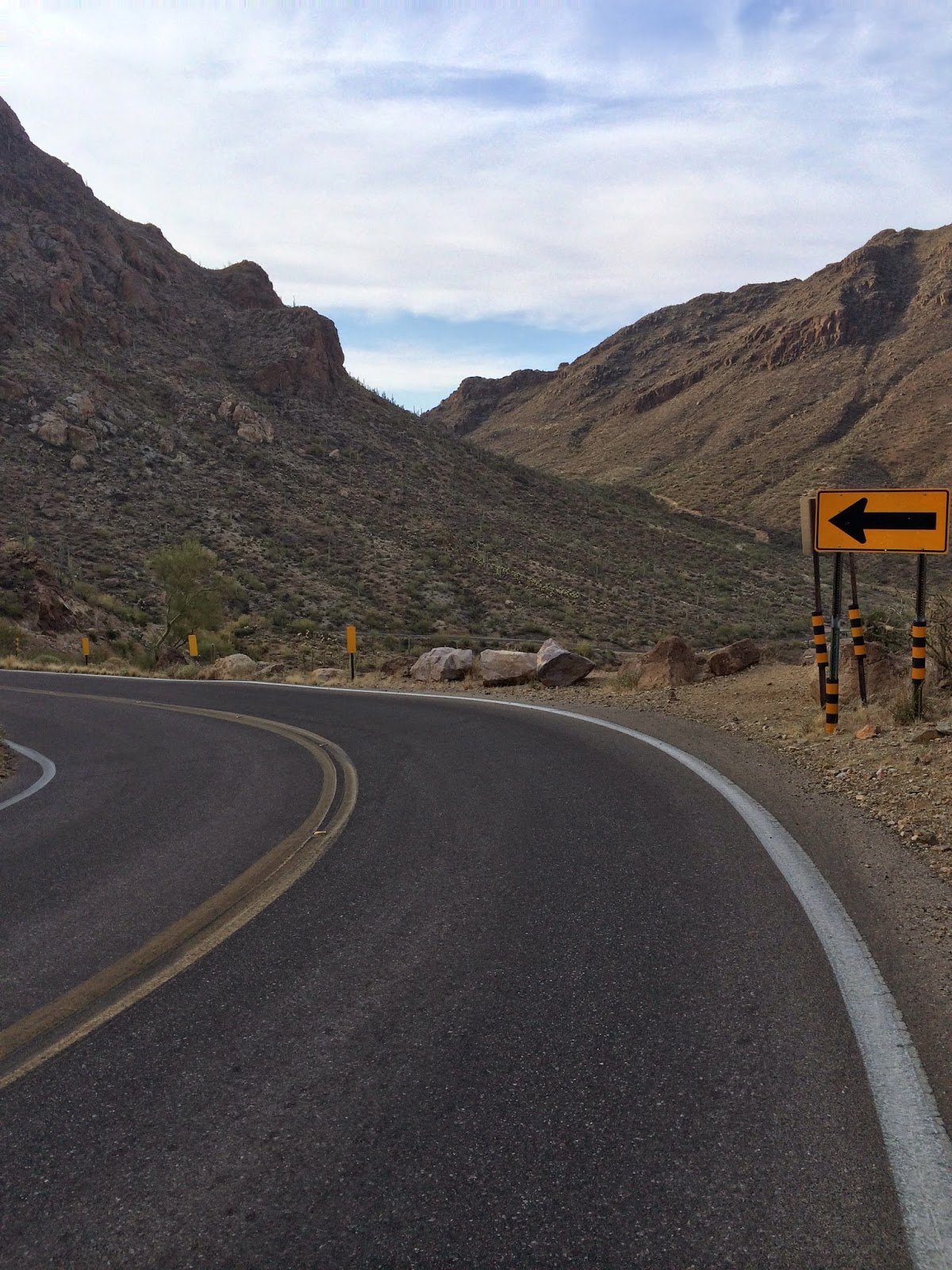
near Kingman, AZ and ride some of route 66, the famous 50s and 60s!
 

I parked my truck at a truck stop, and decided to ride and “out and back” from there, which would be around 40 miles roundtrip. Great lunchtime ride, and was it ever! I started out on route 66, and they have the highway sign painted on the road, very excited at that point! The road is pretty rough, so if your ever riding this, come prepared with extra tubes, heavier tires, and your teeth rattling to the point of falling out, LOL! It was a beautiful winding road, with a pretty decent climb up to the top of the 
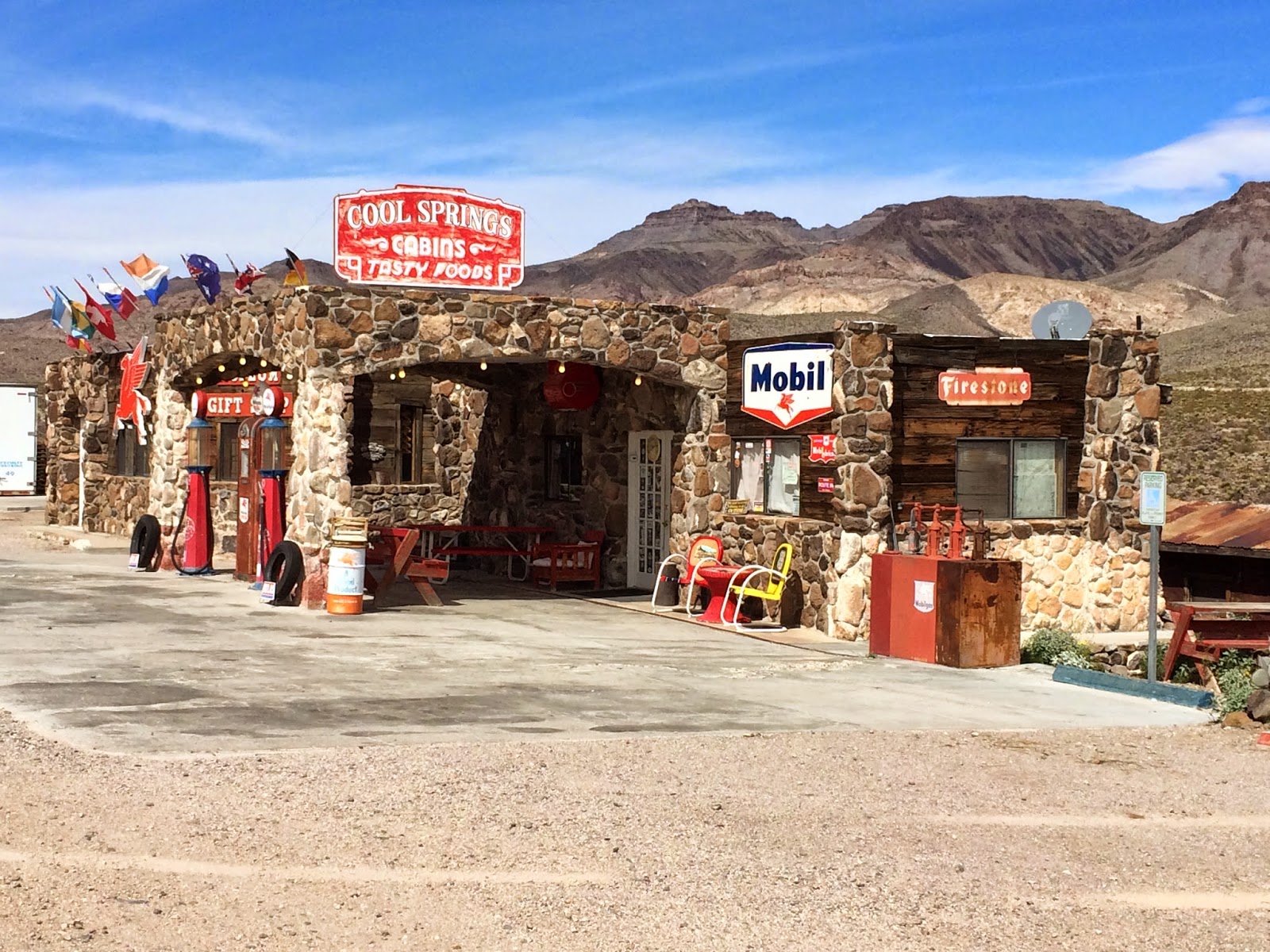
mountain, Sitgreaves Pass. One of my favorite sites along the way is the infamous “Cool Spring” gas stations. I was so excited when I saw this as I was unaware this place was here. The 50’s music was playing and all I could think about was the old convertible cars driving by, which I didn’t see any that day, bummer. I did stop to refill my water bottles here, definitely and must see. I kept on trekking up, as the climb was winding and the road was insight the whole way, I could see the top. Finally arriving at the top, I was able to find someone up there to snap a picture, which they were in bewilderment why anyone was riding a bicycle up this mountain! I didn’t stay long as I wanted to, but had to get back, but I was ear to ear grin the entire way.


I arrived in Boulder City, and found a small little hotel on the old highway downtown, which again, reminiscent of the 50’s hotels. Had a great time catching up with my buddy and we got a few rides in around Boulder City/Las Vegas and Hoover Dam. Boulder City has a designated bike path that circles the mountain between thee and Vegas, that’s 34 miles long. Great pathway to take, as you can see all of Vegas, Lake Mead, and Hoover Dam. Had another ride planned, but we decided not to go as the winds were blowing 30-40 mph.


MT LEMMONS & TUSCON COUNTY PARK, AZ
Our winter time has ended in Mesa, AZ, so off we go for some more travelling. Our first stop was to spend a few days in Tucson, while on our way to New Mexico. Tucson is a great cycling area. Big mountains, some flats, nice little city with lots of culture and history. We found an RV park west of Tucson about 15 miles, which was pretty desolate out there, but great riding. My first ride was up thru Old Tucson and Tucson Mountain County Park, where there have been many of the Old Western movies filmed.  This was a pretty early am ride, as the winds were supposed to be 25-35 afternoon. All I can say is some epic views from the top. Not a long climb to the top, but short and steep, some 11-13% grades. This is a must 40 mile ride if you ever stop by Tucson.


I took a few days off due to the wind and ice predicted in the am, and finally got my chance at Mt. Lemmon. Mt. Lemmon is one of the top 10 toughest climbs in the US, so this was on my bucket list. From the point of least amount of traffic, its 29 miles to the top with about 6500 ft. climbing, with quite a few 6-8% grades!


Views of the valley below the entire way up!  I took off out of Tucson and caught up with a group of local guys that I asked if I could hang on their wheel. Was a little slower than I wanted to go, but I was able to get to know these guys, some great conversations, and learn more about Mt. Lemmon. They pointed out a few bike teams training on Mt. Lemmon along the way. This was a famous winter training ground for Lance Armstrong. I guess he would ride this in the am, come back and work with some local kids cancer programs, then head back up in the afternoon. That’s about 12 miles for the day and almost 14,000ft! The roads are great, super wide shoulders all the way up, many changing sceneries as the bottom is cactus and at the top you’re in the alpine area. Some very breath taking views. When you reach the very top, there’s a skiing village up there and some great little restaurants. Stop in for some famous breakfast, and then ride back down!


Next blog will be rides in New Mexico up to Cloudcroft, Billy the Kid highway by Ruidoso, White Sands to Las Cruces, and Santa Fe/Taos area! Stay tuned!


Saturday, May 3, 2014

2014_05_03 Puyallup Cyclopaths: Carbon River Entrance To Mt. Rainier Ride


This ride, The Carbon River Entrance to Mt. Rainier Ride; starts in Orting and proceeds through South Prairie, Wilkeson, and Carbonado before reaching its final destination: the ranger station at one of the entrances to Mt. Rainier National Park.  It is consists of about 50 miles of riding with approximately 2400 feet of climbing along the way.  It is not a long ride nor does it require a lot of climbing; because it is early in the season, and most of us are just starting to get into shape.
 
Everyone met up for this ride in Orting at the usual starting point (the parking lot in front of the bike shop).  We didn’t quite make our projected start time of 6:45 AM, but we were close.  Thankfully, there was no rain and the temperature was in the mid-forties .  We had a good sized group:  Leon Matz, John Winter, Les Becker, Dwaine Trummert, Conor Collins, Mark Delrosario, Tom Peterson, Gab Scott, Rob Critchfield, Martin Katzberg, Rex ?? (need to learn Rex’s last name), and Mike Hassur.  Before we left, Erik Barrett showed up with three other riders and said that they were doing the same route and would be on the road ahead of us.

 The ride from Orting to South Prairie went by quickly lots of conversation and a brisk pace led by Conor, Rob, and Rex.  Just outside of South Prairie, the group split up as everyone pushed the pace on Tubbs Road Hill and had varying degrees of success (the hill, also, made it clear to many of us that we were over-dressed).  We proceeded in small groups to Wilkeson, where the entire group reformed – only to split apart again on the climb up to Carbonado.  From Carbonado, our band of cyclists mostly stayed together out to our destination:  The Carbon River Entrance To Mt. Rainier.  When we arrived, we encountered both Erik Barrett and his group as well as the only rain of the ride.  It didn’t last long, but it made us start back before taking the traditional photo of our group on the bridge near the ranger station.

 The ride back was fast and fun as detailed in the following video:
 
** Hint:  when you start the video, do the following:
1.  Expand it to full screen by clicking on the "box-like" icon in the far right corner of the video frame
2.  Make sure it is on "high def" by clicking on the "gear-like icon in the same area and selecting "1080p) 


The dynamic of having a good bunch of guys together for a ride is very energizing.  This was a ride that should have been at least a little tiring (especially this early in the year), but it wasn’t.  If I had done it by myself, I know I would have felt some fatigue; but, at the end of the ride, all I felt was the excitement of having seen some of the guys for the first time this year and the giddy realization that we have plenty more of these rides to come this year.  Can’t wait ‘til the next ride.